- Rating: EF-1
- Location: Coe, WV (about 5 miles NNE of Richwood)
- County: Nicholas
- Start Time: 10:58 p.m.
- Estimated Peak Wind: 110 mph
- Path Length: 1,300 yards
- Path Width Maximum: 100 yards
- Fatalities: 0
- Injuries: 1
Details from NWS storm survey: The tornado touched down several times during the path. When it was on the ground, trees were blown down as well as snapped off above the ground. Between the times it was not on the ground, little tree damage was seen during the survey. One camper as well as several trucks were hit by the falling trees.
Radar Imagery
Storm Reports
Surface Setup


SPC Mesoscale Discussion #650 (11:34 PM on April 27th, 2011)


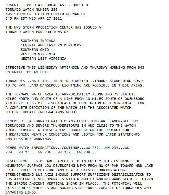
Tornado Watch #239 (5:45 PM April 27th, 2011)