- Rating: EF-0
- Location: Youngs Bottom, WV
- County: Kanawha
- Start Time: 6:45 p.m. (38.47, -81.44, time of tornado likely a few minutes beforehand)
- Estimated Peak Wind: 80 mph
- Path Length: 300 yards
- Path Width Maximum: 50 yards
- Fatalities: 0
- Injuries: 0
Details from NWS storm survey: The National Weather Service has confirmed that a tornado briefly touched down in Youngs Bottom just northeast of Elkview yesterday - March 19th at 645 pm. The tornado has been rated an EF-0, with winds estimated at 80 mph. The path of the tornado was 50 yards wide and 300 yards long. The tornado downed numerous trees, produced structural damage to several structures, rolled a camper into a telephone pole, lifted a pontoon boat onto a fence and damaged shingles on numerous structures. The wind gust of 85 mph (this was later revised to 84 mph, which was still a recorded) at Charleston's Yeager Airport yesterday March 19th was the highest wind gust ever recorded at the airport. The previous record high wind gust was 76 mph on July 26th 2007. Straight line winds of 70 to 100 mph were recorded around the Clendenin, Pinch and Elkview areas.
Radar Imagery
This is a classic case of a QLCS - a Quasi-Linear Convective System - that produced a brief spin-up tornado in northeastern Kanawha County, while resulting in wind damage from straight line winds elsewhere. Notice in the animation below the sudden "bend" in the line just north of the bow's apex. This is where tornado activity is typically possible, as was the case with this storm.

The image blow shows the "bend" forming in the QLCS across northeastern Kanawha County between Elkview and Pinch at 6:36 PM along the bow line. Notice the area of weaker returns in radar to the south and west (green and yellow) - this is known as a weak echo channel (or WEC) - generally, the tornado threat will be just northeast of the WEC.

By 6:40 PM, the tornado has already likely already occurred, as the area of circulation moves parallel to US-119. Notice the WEC over Pinch.

A side-by-side look at Base Reflectivity and Base Velocity allows us to see how the structure of the system works. A rear-inflow jet (RIJ) - and a strong one - "encourages" the developing circulation to wrap, resulting in the brief tornado.

Unfortunately, it is not easy to see that rotation is occurring examining the Base Velocity data. It is apparent that there are damaging straight-line winds occurring south of the circulation at 6:41 PM in the image below. But the circulation is seemingly obscured until you zoom in.

When zoomed in to street-level, you can see the circulation a little easier (orange and green) - where 91.7 mph of gate-to-gate shear is shown near Chestnuthill Drive and Runnion Road north of Keith's Auto Parts near Clendenin.

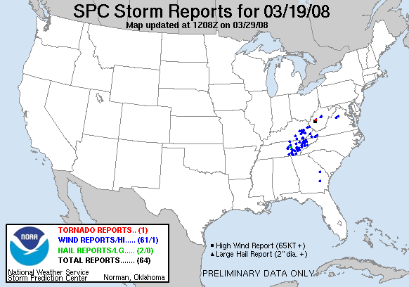
Storm Reports
Though the emphasis of this article is on the tornado itself for documentation purposes, damaging wind gusts also caused quite a bit of damage. A few storm reports were recorded:
- Damaging Winds: 6:22 p.m. - Clendenin (Kanawha). Trees down. Event occurred between 5:52 p.m. and 6:22 p.m. The old record was 76 mph recorded on July 26th, 2007.
- Damaging Winds: 6:31 p.m. - 84 mph wind gust measured at Yeager Airport - a new record.
- Hail: 6:31 p.m. - Hail of 1/2" diameter recorded at Yeager Airport.
- Tornado: 6:45 p.m. - 3 miles northeast of Elkview (Kanawha). Confirmed EF-0 tornado in Youngs Bottom. Winds estimated at 80 mph. 50 yards wide. 300 yards long.
- Damaging Winds: 6:58 p.m. - Pinch (Kanawha). Multiple trees and power lines down in Pinch along Route 119.
- Damaging Winds: 7:23 p.m. - 3 miles northeast of Heaters (Braxton). Power lines down at Napier on Route 19.
- Damaging Winds: 7:23 p.m. - 1 mile north-northeast of Gassaway (Braxton). Chappel Road, tree down blocking road.
- Damaging Winds: 7:23 p.m. - Little Birch (Braxton). Bus house blown over into roadway on Old Route 19.
- Damaging Winds: 7:30 p.m. - Clendenin (Kanawha). Trailer blown off foundation.
Surface Setup

A surface low located overhead with a stalled frontal boundary likely led to low level wind shear, so that very little instability was needed to enable severe weather to take place. This is not that uncommon of a scenario in West Virginia during the late winter and early spring (known as "high shear, low CAPE" severe weather days)
Storm Prediction Center Convective Outlooks (Issued at 20Z on March 19th, 2008)


Severe Thunderstorm Watch #136 (March 19th, 2008)


Mesoscale Discussion #477 (March 19th, 2008)

